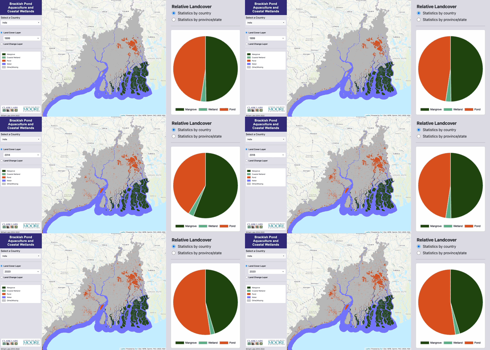
Blue Raster is helping Clark Labs, an entity of Clark University in Worcester, Massachusetts, with critical enhancements to its coastal habitat web mapping application that tracks and maps mangroves, pond aquaculture, and coastal habitats from all around the globe. Created in partnership with the Gordon and Betty Moore Foundation in support of the Foundation’s Oceans and Seafood Markets Initiative, the Brackish Pond Aquaculture and Coastal Wetlands interactive map will help to protect and conserve coastal habitats and marine life from overconsumption.
Task 1: Enhancements and Infrastructure Maintenance
The coastal habitat monitoring application was originally built using open-source technology; however, our expertise was requested to enhance the application to meet current industry standards using Esri technology. To start the process, we began with Amazon AWS Cloud and GeoServer infrastructure maintenance and enhancements. This task required stabilizing and improving the infrastructure for the coastal habitat web map application. To do so, our team completed the following requirements:
- Ensured the SSL certificate was set up and renewed automatically.
- Reviewed hosting security and software versions to confirm the site is secure.
- Migrated the download function to CloudFront for improved user experience.
Clark Labs also wanted to simplify the aquaculture application, so our team implemented new services for improved data management, reduced cost, and better performance. This also included migration from GeoServer to ArcGIS Online to streamline management.
Task 2: Data Updates
After the infrastructure maintenance and application enhancements were made, the application was handed off to the backend team at Blue Raster. Data updates were established on an as-needed basis to the coastal habitat web map application, with Blue Raster providing guidance for updating Clark Labs' web map data content when a data update is available and ready for publishing. The application depends on Landsat imagery data to complete change detections for its interactive map, so it’s crucial for tracking purposes that the conversion data is updated accurately.
Task 3: Code Maintenance
Our Blue Raster developers also played a role in the code maintenance for the coastal habitat web map. They were responsible for reviewing existing web applications and publishing practices code to determine what could be reused and enhanced for Clark Labs’ application. Our developers revised existing software scripts where it was applicable, enacted performance improvements to the front-end user experience, and reviewed existing designs and flagged any updates that required alterations.
What's Next for the Coastal Habitat Web Map
Currently, the Blue Raster team is in the process of transferring the Brackish Pond Aquaculture and Coastal Wetlands web map from open-source technology to Esri technology, but the improved infrastructure, data updates, and current code maintenance will help us ensure that the web map application is functioning properly and providing users with a better-quality experience.
Explore Clark Labs’ Interactive Web Map for Brackish Pond Aquaculture and Coastal Wetlands >
