Mobilize your workforce from a selection of configurable apps and
dashboards such as Collector, Survey123 and Workforce for ArcGIS


Ever-increasing is the need and desire to collect and edit geospatial data from the field. Armed with a collection of configurable mobile applications, take the ability to create, update or delete data away from the office, in both connected or disconnected environments. From collecting survey data to groundtruthing with maps on your device, these applications can be tailored to fit your project specifications. Blue Raster can help you build, map, survey and monitor field work.
WITH ArcGIS Online, YOU ALREADY HAVE ACCESS TO THE FOLLOWING: ![]()
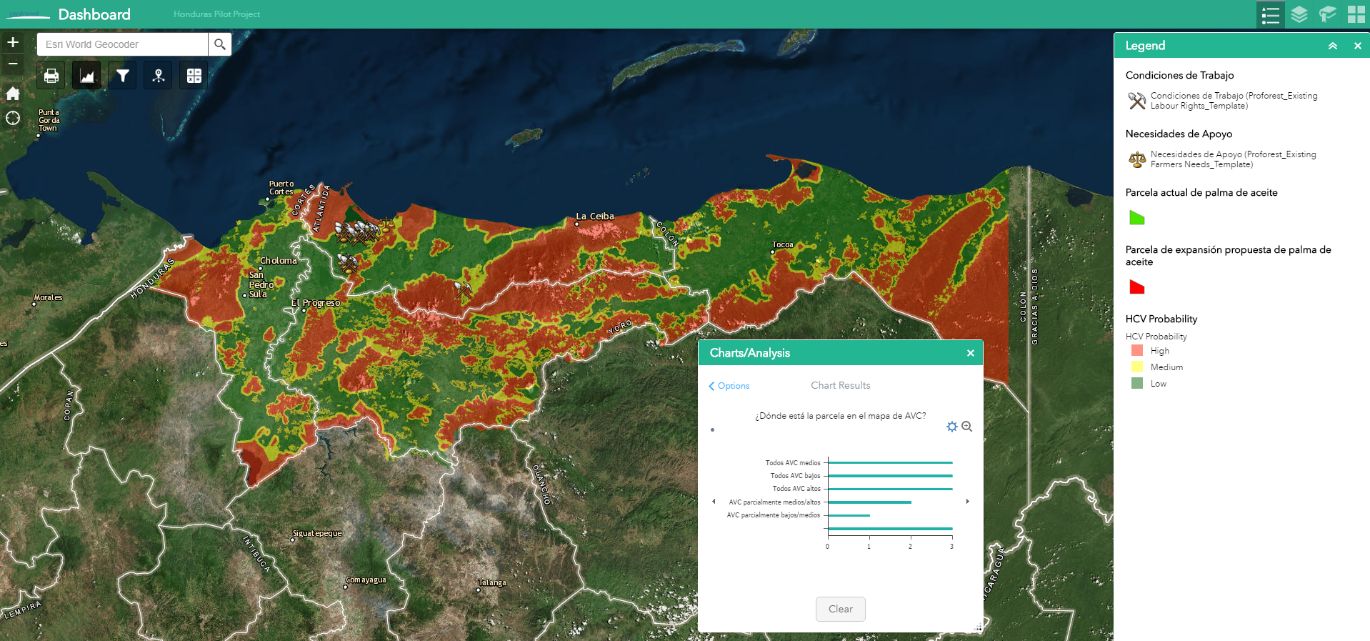
In 2016, Blue Raster worked with The Proforest Initiative to implement Esri mobile data collection capabilities for smallholder farmers in Honduras hoping to become RSPO certified. Using Survey123 for ArcGIS, smart forms were configured in both English and Spanish that asked farmers questions about crop yield, training, food security and labor rights/worker conditions. In some fields, users manually entered text while in others they choose on
 e or multiple options from a list of selections. Depending on their answers, related questions appeared, keeping the form as short and tailored as possible. Constraints and required fields made sure that the data uploaded from the survey was as complete and accurate as possible. Users finished the survey by adding their location and a picture from the field.
Using Collector for ArcGIS, a map-centric mobile collection application, farmers could plot their existing lands and proposed expansions and provide basic attribution for land rights and whether their land is contested. Both Collector and Survey123 were arranged to work offline, and data could be synched when internet connectivity available.
An interactive application configured using Web AppBuilder for ArcGIS was used to manage the data coming in from the field, filter on key metrics and perform basic analyses.
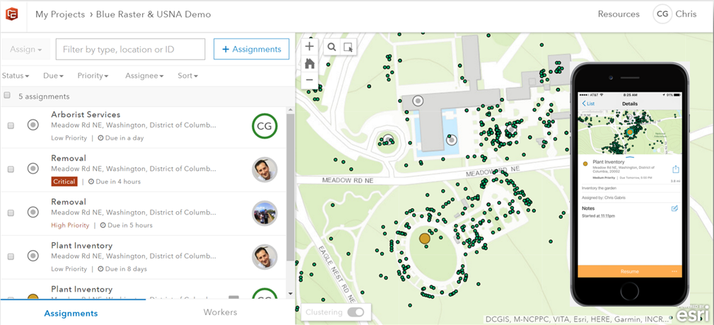
At the US National Arboretum, the location and attributes of over 30,000 plants and trees is managed using GIS. Services around the grounds, such as inventory, removal of dead plants, or pest management are traditionally assigned as work orders and recorded with pen and paper. Understanding the many benefits of managing field work with mobile GIS collection tools, the facilities team has begun using Workforce for ArcGIS to create and track work order assignments. Workforce for ArcGIS integrates with Collector for ArcGIS, so that data can be created, updated or deleted in the field at the time and avoid duplicate efforts.


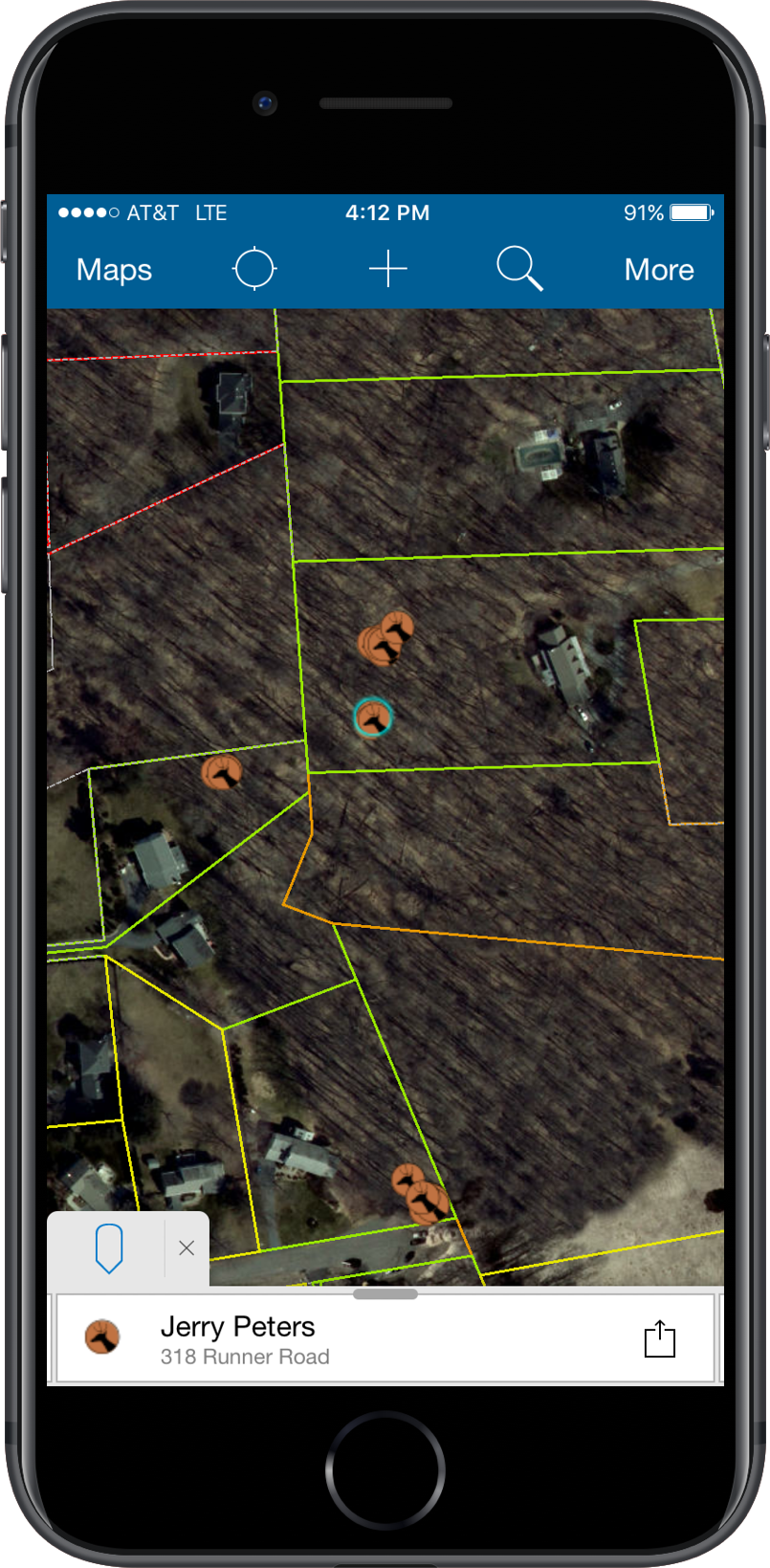 The overabundance of deer cause great threat to the plant and animal species that make up their habitats. Deer on the roads can also damage property and people. Green Fire GIS, a non-profit organization in Fairfax County, Virginia aims to manage the deer population through a cooperation between landowners and bow hunters. Using Collector for ArcGIS, parcel data joined with property owner information is color coded by Access (Hunt, To be Contacted, Refused Permission, etc.) and viewable to hunters within Green Fire. Hunters then log their hunt and deer observations, populating attributes for date/time, count, sex and age of deer seen, shots taken and deer retrieved. The observations are then aggregated by Green Fire management to identify patterns and trends of deer populations across the county. Using Collector for ArcGIS since 2015, this project has the ability to scale up beyond Fairfax County in Northern Virginia, and can be a template for other parts of the State and Country.
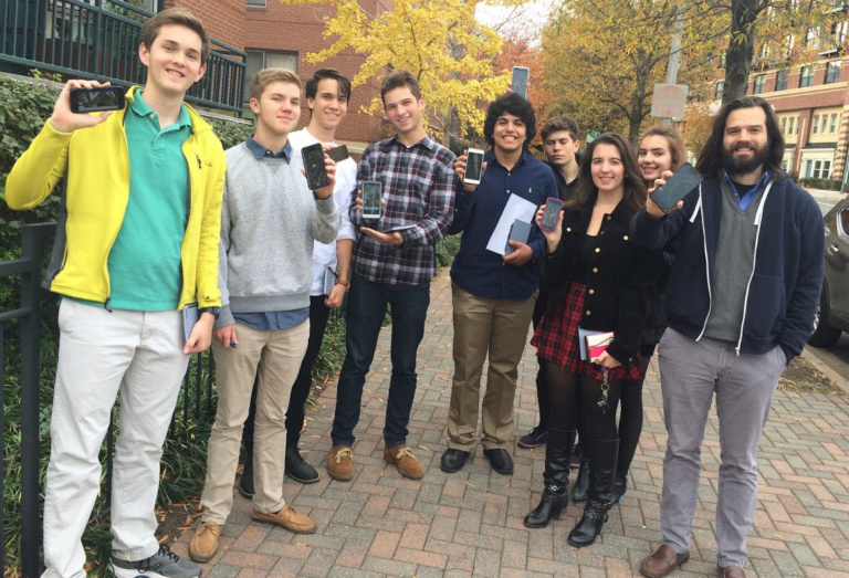
For the past five years, Blue Raster has teamed up with Washington-Lee High School in Arlington, Virginia on GIS Day to share with students the latest trends in geospatial technology and real-world use cases. Collecting an inventory of nearby assets, from trees to restaurants to public transportation options, Blue Raster configured Collector for ArcGIS for the students to gather data in the field. Using a preconfigured Operations Dashboard, collections and metrics updated back in the office in real-time, where students could look for spatial patterns, filter the data, and see who collected the most features.

Let us help you add configurable mobile applications and dashboards to your workflows and discover all the ways it can elevate your work. Interested in learning more? Contact us to hear about our customized, hands-on training.