Skip to content
About
About Us
Careers
Events
GIS for Good
Contact Us
Services
Web Application Development
Mobile Application Development
Managed Services
Software & Data Solutions
GIS Consulting
UX | UI Design
Capabilities
Stories
Resources
Press
Webinars
Newsletters
Branding & Styling
Partnerships
Esri ArcGIS Solutions
REGRID Parcel Data
Planet Labs Imagery
Microsoft Solutions
Menu
Menu
Archive
infrastructure
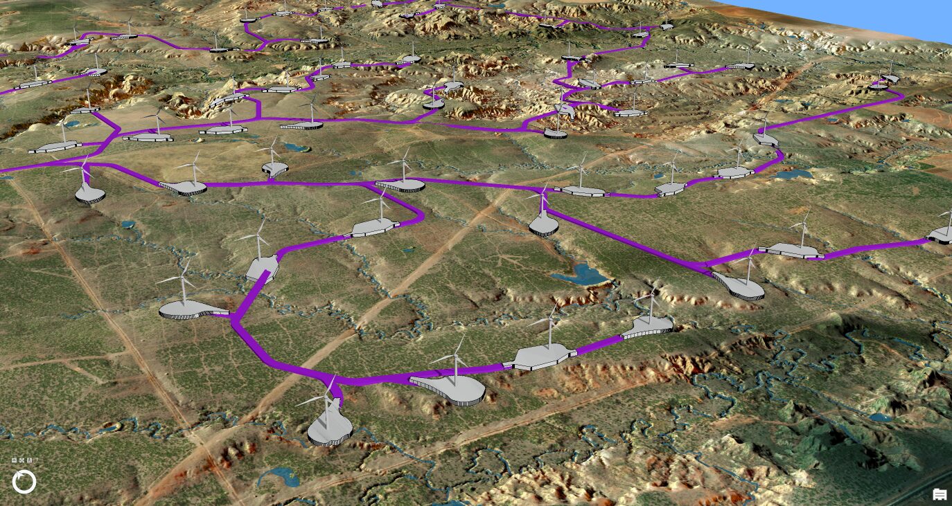
Streamlining Wind Farm Design and Optimizing Construction Planning with GIS
September 17, 2025
Esri ArcGIS Cloud Services Specialty: Elevating Our Clients’ GIS Capabilities to the Sky
August 26, 2022
Haverford College Campus Placefinder
August 22, 2022
Disposal of Debris after Disaster: Blue Raster partners with CDR Maguire to quantify and monitor disposal of debris material
July 19, 2022
In It For the Long Haul: Transload Distribution Association partners with Blue Raster to visualize, analyze and prioritize
July 1, 2022
New Era for Plant Mapping at New York Botanical Garden with PlantTracker
March 4, 2022
Driving Forward with VDOT’s Integrated Directional Signing Program
March 4, 2022
Mekong Monitor – Providing Vital Insight for River-dependent Communities
March 2, 2022
Work Locations Tool for Landscape Crews
October 22, 2021
Manassas Park Deploys ArcGIS Tools to Modernize IT Infrastructure
October 1, 2021
1
2
3
Next »
Back To Stories & Blog Posts
About
About Us
Careers
Events
GIS for Good
Contact Us
Services
Web Application Development
Mobile Application Development
Managed Services
Software & Data Solutions
GIS Consulting
UX | UI Design
Capabilities
Stories
Resources
Press
Webinars
Newsletters
Branding & Styling
Partnerships
Esri ArcGIS Solutions
REGRID Parcel Data
Planet Labs Imagery
Microsoft Solutions
Scroll to Top