Community

ArcGIS Experience Builder, ArcGIS Instant Apps, ArcGIS Online, Community, Development, Economic Development, Environment, GIS, Nonprofit/NGO, Survey123, Sustainable Development Goals, Training

The New NC Equitable Foodshed Map is Amplifying Support for Farmers and Ranchers in North Carolina

Blue Raster recently partnered with the Croatan Institute to enhance the NC Equitable Foodshed Map, a crucial resource for underserved farmers and ranchers. As part of the REEFS program, the map supports racial equity and economic sustainability by connecting users to vital resources. We transitioned the legacy application from ArcGIS Web App Builder to ArcGIS Experience Builder, offering a more flexible, dynamic platform. Additionally, we integrated ArcGIS Survey123 to gather user feedback, ensuring continuous improvement of the map

ArcGIS Data Pipelines, ArcGIS Experience Builder, ArcGIS Online, Cloud, Community, Conservation, Culture, Economic Development, Environment, Federal, GIS, Google Cloud Platform, Tourism

Promoting Tourism Development Strategy in Canada with GIS and Data-Driven Insights

Blue Raster is supporting Destination Canada by enhancing TourismScapes, an interactive tool that provides insights into Canada’s tourism sectors. We’ve helped integrate big data from Google Cloud Platform into ArcGIS Online for real-time updates and improved accessibility. Additionally, our work with ArcGIS Experience Builder has streamlined the platform’s user interface, allowing stakeholders to easily explore key indicators and community assets.

ArcGIS Dashboards, ArcGIS Experience Builder, ArcGIS Online, Community, Design, Development, Environment, GIS, State & Local, Survey123

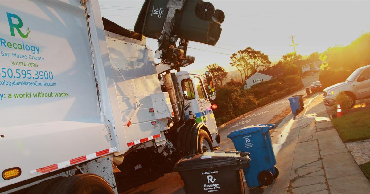
Utilizing Smart GIS Solutions to Drive California Recycling Mandates

Faced with California’s ambitious recycling mandates—AB 341, AB 1826, and SB 1383—San Mateo County turned to GIS to track, manage, and report compliance across its communities. Blue Raster partnered with the County to build a smart, centralized application using ArcGIS Experience Builder, ArcGIS Online, and Survey123. The result? A powerful tool that streamlines inspections, visualizes hauler service routes, simplifies reporting, and supports the County’s mission to reduce waste and meet state environmental goals.

ArcGIS Dashboards, ArcGIS Experience Builder, ArcGIS Online, Community, Culture, Economic Development, GIS, Media, Mobile, Nonprofit/NGO, Survey123

Supporting the 2024 AANHPI National Unity Summit

Blue Raster supported the Asian American Unity Coalition (AAUC) at the 2024 AANHPI Unity Summit in Washington, D.C., focusing on civic engagement and advocacy for key issues like immigration and civil rights. Our team helped amplify AAPI voices by utilizing ArcGIS technology to drive change and enhance community engagement. Learn how Blue Raster’s commitment to “GIS for Good” plays a crucial role in fostering unity and creating impactful solutions for underrepresented communities.

ArcGIS Dashboards, ArcGIS Experience Builder, ArcGIS Hub, ArcGIS Pro, ArcGIS StoryMaps, ArcGIS Urban, Community, Development, Economic Development, Esri, GIS, Infrastructure, Nonprofit/NGO, State & Local

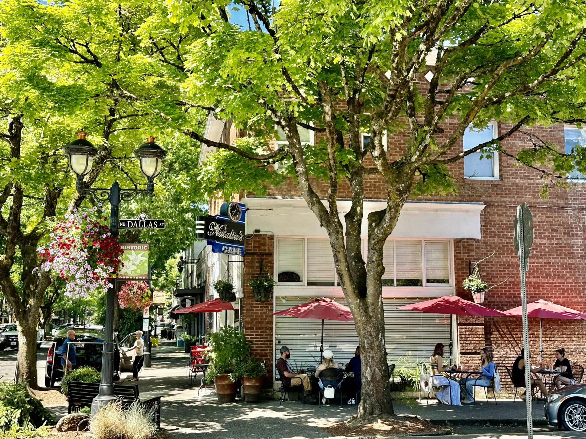
Revitalizing Main Street: Tracking Community Opportunities with BOOMS Tracker

Discover how Blue Raster supports Main Street America with the BOOMS Tracker, a property inventory tool designed to revitalize historic commercial districts. Using advanced geospatial technologies like ArcGIS Pro and ArcGIS Hub Premium, the BOOMS Tracker helps local leaders collect and analyze data on housing, businesses, and civic spaces, identifying development opportunities to drive community growth. Learn how our innovative solutions can enhance your projects and foster economic vitality. Contact Blue Raster today to get started!

Community, Conservation, Culture, Education, Environment, GIS, Media, Nonprofit/NGO, Water

Above the Waters: A Cinematic Journey Through the Delaware River Watershed

The Delaware River holds a rich tapestry of history, playing a pivotal role in the development of the United States and serving as a witness to centuries of human activity. Flowing for approximately 330 miles through the eastern United States, the river originates in the Catskill Mountains of New York and eventually empties into the Delaware Bay.

Scroll to Top