Skip to content
About
About Us
Careers
Events
GIS for Good
Contact Us
Services
Web Application Development
Mobile Application Development
Managed Services
Software & Data Solutions
GIS Consulting
UX | UI Design
Capabilities
Stories
Resources
Press
Webinars
Newsletters
Branding & Styling
Partnerships
Esri ArcGIS Solutions
REGRID Parcel Data
Planet Labs Imagery
Microsoft Solutions
Menu
Menu
Archive
Public Safety
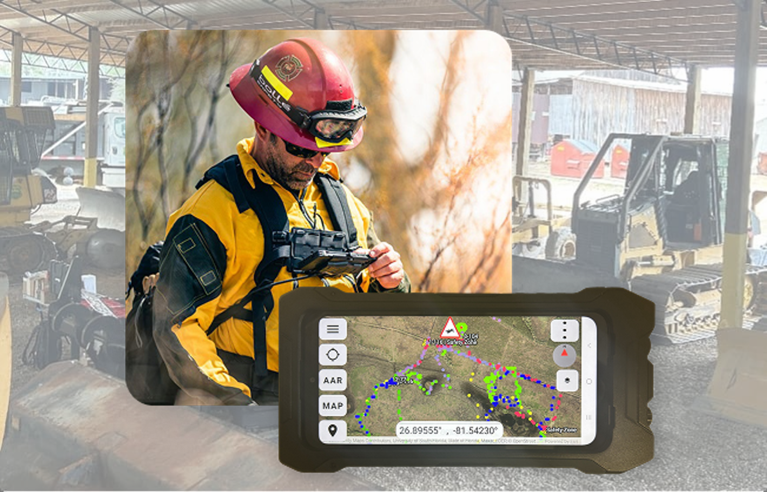
From the Field to the Command Center: Powering Advanced Situational Awareness
March 3, 2026
Blue Raster Exhibits and Presents at the 2023 North Carolina ArcGIS Users Group Conference
October 16, 2023
Disposal of Debris after Disaster: Blue Raster partners with CDR Maguire to quantify and monitor disposal of debris material
July 19, 2022
Modeling a Decision Support System in Response to COVID-19
March 2, 2022
Manassas Park Deploys ArcGIS Tools to
Modernize IT Infrastructure
October 1, 2021
World AIDS Day 2017: Blue Raster visualizations in PHIA Project Reports
December 1, 2017
WHO Malaria Threats Map: Tracking challenges of malaria control to 2030
November 28, 2017
A New Chapter on Tsunami Design
July 20, 2017
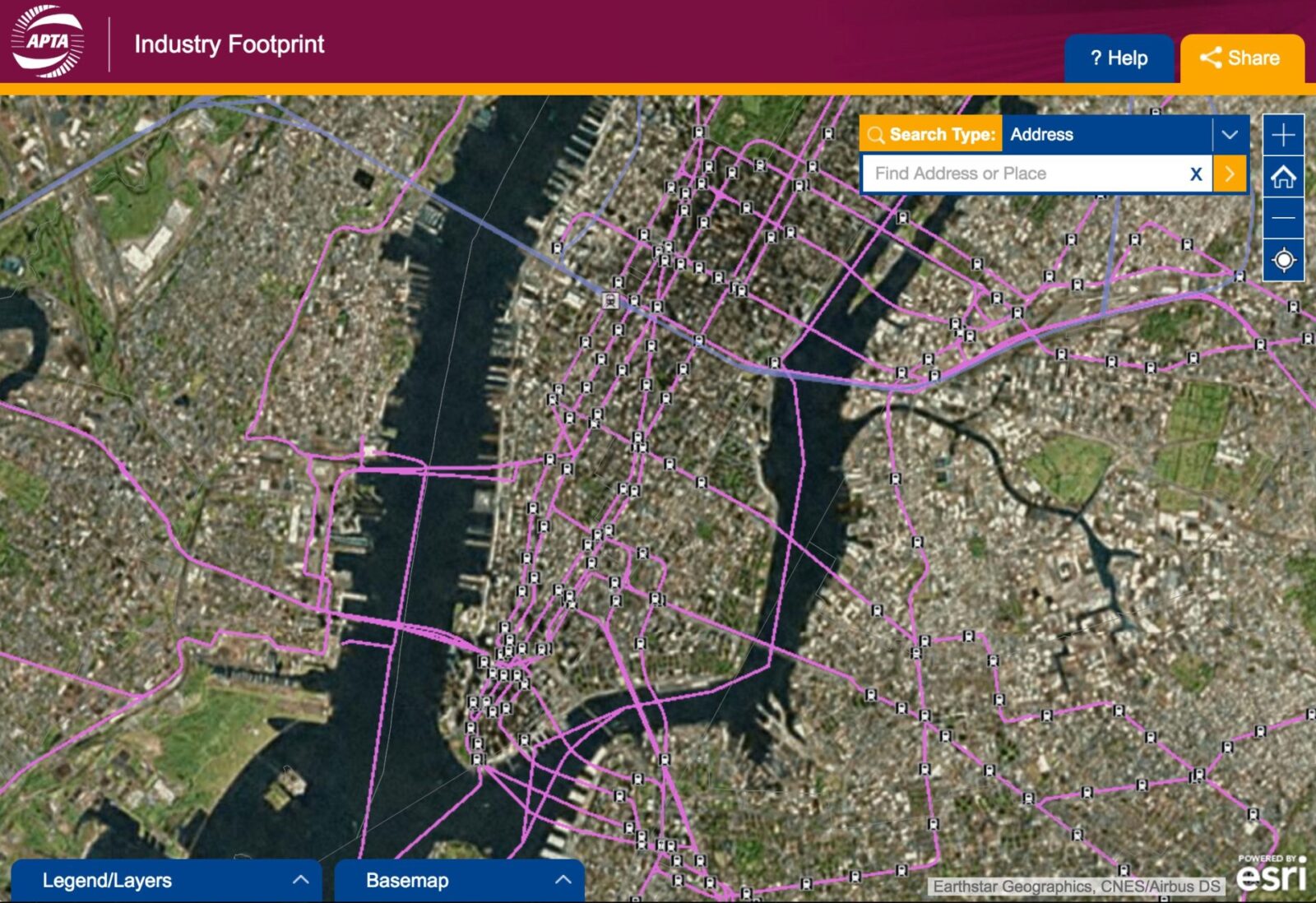
New Release: APTA Industry Footprint
October 25, 2016
Enhancing Public Access to GIS
February 23, 2016
1
2
Next »
Back To Stories & Blog Posts
About
About Us
Careers
Events
GIS for Good
Contact Us
Services
Web Application Development
Mobile Application Development
Managed Services
Software & Data Solutions
GIS Consulting
UX | UI Design
Capabilities
Stories
Resources
Press
Webinars
Newsletters
Branding & Styling
Partnerships
Esri ArcGIS Solutions
REGRID Parcel Data
Planet Labs Imagery
Microsoft Solutions
Scroll to Top