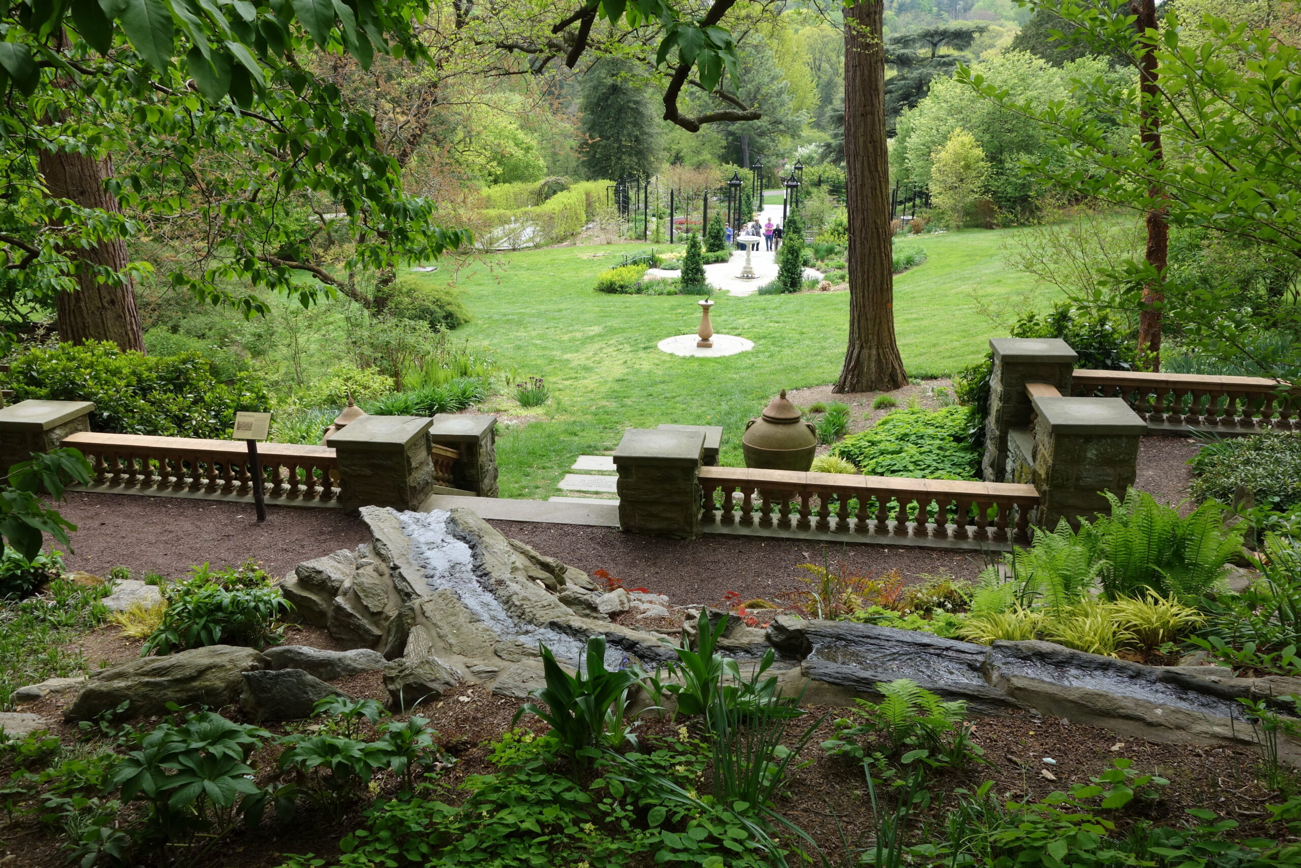
Set on 92 acres in Philadelphia's Chestnut Hill neighborhood, the Morris Arboretum & Gardens of the University of Pennsylvania is home to more than 11,000 accessioned plants representing over 2,500 taxa. To properly document and display this collection, Morris Arboretum & Gardens partnered with Blue Raster to create Garden Explorer, a web- and mobile-friendly application that puts the arboretum's living collection at visitors' fingertips.
After receiving an Institute of Museum and Library Services (IMLS) grant in 2022, Morris staff began collecting high-accuracy GPS locations for each of its accessioned plants using ArcGIS Field Maps. With plant locations captured, Blue Raster worked with the Morris team to connect its plant collections management system, BG-BASE, with the newly collected GPS points, and drone-captured basemap imagery, bringing it all together in Garden Explorer, their first interactive, public-facing map of the collection.
Navigate the Garden Explorer App:
Garden Exploration made easy with GIS
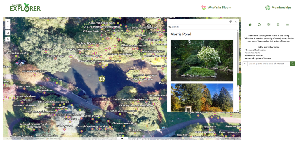
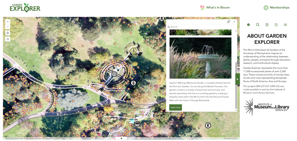
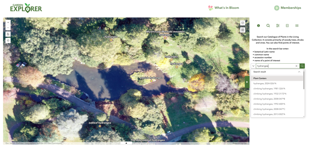
Built with ArcGIS Experience Builder, Garden Explorer lets visitors search the collection by plant name, accession number, or garden feature, then pulls up photos and details on their phone. With location services enabled, users can see exactly where they are on the map relative to nearby plants, amenities, and points of interest. The same map is also available from a desktop browser, so visitors can explore the collection or plan a route before they ever set foot on the grounds.
Our Rich History with Public Gardens & Arboreta
Garden Explorer joins a series of public gardens Blue Raster has helped connect visitors to their collections through GIS-powered mapping. As collections grow and record-keeping moves further into the field, tools like these are becoming essential, not just for public engagement, but for the day-to-day work of plant records and curatorial staff who rely on accurate, up-to-date spatial data.
Bring Your Living Collection to Life
Blue Raster has spent over a decade helping public gardens, arboreta, and cemeteries modernize their plant records and build mapping tools that work for both staff and visitors. If your institution is ready to bring your collection to life on the map, contact us today.