
Organizations have more location data available to them than ever before. The challenge is that the information rarely lives in one place. Property records may sit in spreadsheets, operational data in a CRM or asset management platform, GIS layers in ArcGIS, reports in shared folders, and important institutional knowledge with individual team members.
That fragmentation creates more than a data-management problem. It creates duplicate work, uncertainty around which information is current, and additional steps between a question and a decision.

Across the GIS projects we are seeing today, modernization increasingly means solving that larger problem. Instead of building another standalone map, organizations are looking for a connected geospatial foundation that brings location into the broader flow of information.
What Is a Geospatial System of Record?
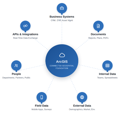
A geospatial system of record is the trusted foundation for an organization's spatial data, services, and workflows. In many cases, ArcGIS Online or ArcGIS Enterprise provides that foundation by giving teams a governed place to publish authoritative layers, manage access, build applications, perform analysis, and connect location data to other systems.
That does not mean GIS needs to replace every business platform. A CRM may remain authoritative for contacts. An asset management system may own maintenance records. A financial system may own transaction data. The goal is to establish clear ownership and reliable connections so that the right information can move between systems without creating another silo.
A modern geospatial foundation connects:
Start With the Data, Not the App
It is tempting to begin a modernization effort with the part everyone can see: the new web application. But a polished interface cannot fix inconsistent schemas, duplicate records, unclear ownership, or manual update processes underneath it.
A stronger approach starts by inventorying the data and the workflows around it. Which datasets are authoritative? Who maintains them? How often do they change? Which information belongs in GIS, and which should remain in another system? Once those questions are answered, teams can consolidate and clean spatial data, establish hosted services, define permissions, and create repeatable update processes.
Connect GIS to the Rest of the Organization
The next step is moving beyond one-time imports. APIs, Python automation, scheduled synchronization, and other integration patterns can allow GIS to stay connected to the systems people already use.
This is where a modern GIS begins to feel less like a mapping destination and more like infrastructure. A record updated in a business system can become available spatially. A field update can feed a dashboard. A location-based analysis can support a report or downstream workflow. The map is still important, but it is now one part of a larger connected process.
Build Around the Decision
Once the foundation is reliable, the user experience can be designed around what people actually need to accomplish. ArcGIS Experience Builder, Dashboards, mobile applications, reporting tools, and custom interfaces each solve different problems. The right choice depends less on which tool is newest and more on the decision or action the user needs to take.
For one team, that may mean quickly evaluating properties and surrounding conditions. For another, it may mean tracking program activity across a region, producing consistent map outputs, or giving non-GIS staff a simple way to find and understand authoritative information.
Design for Ownership After Launch
Modernization also needs to account for what happens after implementation. Where will the solution live? Who controls the data and licenses? How will permissions be managed? What documentation will be available? How will the platform evolve as requirements change?
Building within an organization's own ArcGIS environment, documenting integrations, establishing governance, and planning for maintenance can make the difference between a successful launch and a platform that is still delivering value several years later.
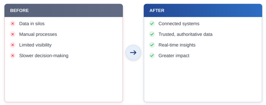
What modernization actually changes:
Real Outcomes, Not Just Maps
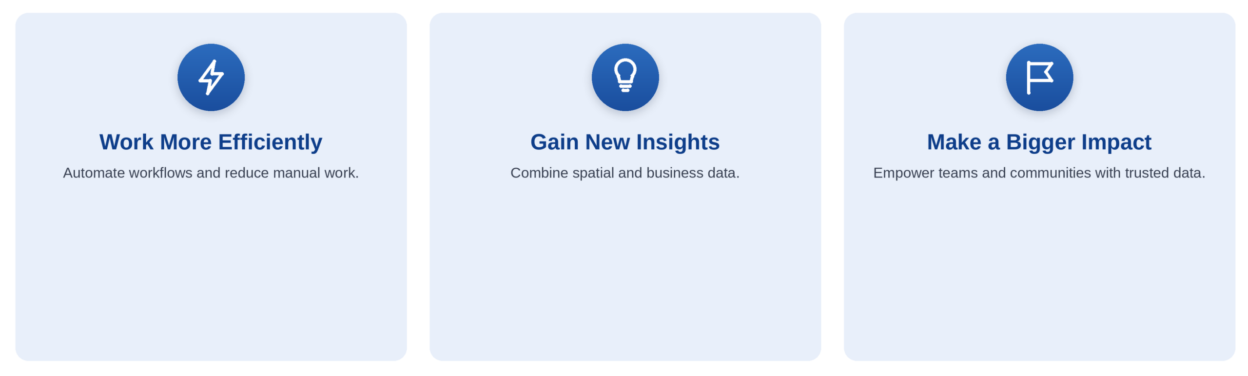
When geospatial data is integrated into your broader technology ecosystem, it becomes a powerful driver for your organization - supporting everything from operational efficiency to long-term strategic planning.
What This Means for Commercial and Commercial Real Estate Teams
Few sectors make the case for a geospatial system of record as clearly as commercial and commercial real estate. Site selection, market feasibility, and portfolio decisions all depend on pulling together data that typically lives in separate places: parcel and ownership records, demographic and trade-area reports, broker and CRM contacts, zoning and suitability layers, and property performance metrics.
Connected within a system of record built on ArcGIS Pro and ArcGIS Business Analyst, that information stops being a set of static reports. Trade areas and drive-time models stay current as markets shift. Parcel boundaries and ownership data stay linked to the sites being evaluated. Dashboards built in ArcGIS Experience Builder give portfolio-wide visibility instead of one-off spreadsheets rebuilt for every new market.
Blue Raster has built exactly this kind of foundation for commercial clients - including a multi-state expansion dashboard for a materials supplier covering more than 470 counties, combining performance metrics, suitability indexes, and drive-time analysis so the team could evaluate new markets from one place instead of stitching reports together market by market.
Looking Ahead
As organizations continue to modernize, the most valuable GIS platforms will increasingly operate behind the scenes - connecting systems, adding spatial context, and making trusted information available wherever decisions are being made.
That foundation also creates the opportunity for more advanced analytics, automation, and AI-assisted workflows. But those capabilities become far more useful when the underlying data is already connected, governed, and ready to use.
A modern GIS is not just about better maps. It is about giving people the right information, at the right time, so they can make a difference.
At Blue Raster, we help organizations design and implement modern GIS solutions that connect data, applications, and people - turning location information into workflows that can grow with the organization.